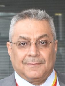
Oday Zakariya Jasim

My research focus mainly on Urban Planning & Digital mapping, I’m also interested in Surveying engineering & Remote sensing and Astronomy surveying
Title
Professor
Education
- Ph.D, Urban &Regional Planning , University Of Baghdad, Iraq , 2013.
- M.Sc., Urban &Regional Planning , University Of Baghdad, Iraq, 1999.
- B.Sc., Surveying Engineering , College of Engineering, University of Baghdad, Iraq, 1988.
Research Interests
- Urban Planning
- Digital Mapping
- Surveying Engineering
- Surveying Astronomy
- Remote Sensing
Teaching
- Urban Planning
- Digital Mapping
- Surveying Engineering
- Land Surveying I (Astronomy Surveying)
- Land Surveying II
- Cadastral Surveying
- Advanced GIS Spatial Analysis
Most recent publications
- Using of machines learning in extraction of urban roads from DEM of LIDAR data: Case study at Baghdad expressways, Iraq
- Integrating various satellite images for identification of the water bodies through using machine learning: A case study of Salah Adin, Iraq
- Urban expansion of Baghdad city and its impact on the formation of Thermal Island based upon Multi-Temporal Analysis of satellite images
- MODIS and Landsat satellite images comparison for modeling near surface air temperature
- Mapping LCLU Using Python Scripting
- Integrating various satellite images for identification of the water bodies through using machine learning: A case study of Salah Adin, Iraq
- Combination of visible and thermal remotely sensed data for enhancement of Land Cover Classification by using satellite imagery
- Large Scale Map Production using Unmanned Aerial Vehicles
- Environmental and Urban Land Use Analysis by GIS in AL-Shaab of Baghdad as a case study
- Proposal of building a standard geodatabase for urban land use
- Digital Geomatics Trends for Production and Updating Topographic Map by Using Digital Generalization Procedures
- Change detection and building spatial geodatabase for Iraqi marshes
- Air Temperature Modeling Depended on Remote Sensing Techniques
- Land Surface Temperature Retrieval from LANDSAT-8 Thermal Infrared Sensor Data and Validation with Infrared Thermometer Camera
- Estimation High Resolution Air Temperature Based on landsat8 images and Climate Datasets
- Preparing a comprehensive geodatabase for Iraq geodetic networks systems
- DAAD Award, Germany, 2005
- ENDEAVUR Award, Australia, 2007
- AIAH Award, Netherlands, 2009
- DAAD Award, Germany, 2010
- DAAD Award, Germany, 2018


